
Typhoon Jangmi churns toward southern Japan
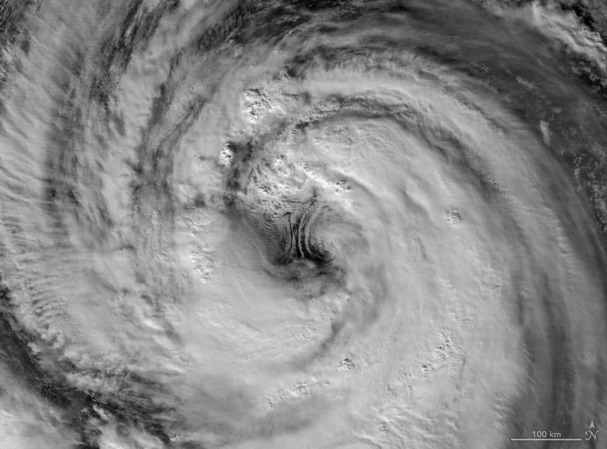
From late May into early June 2026, a broad, slow-spinning storm moved north-northwest over the Philippine Sea toward southern Japan. The VIIRS instrument on the Suomi NPP satellite captured a nighttime image at about 16:40 Universal Time on May 30 (1:40 a.m. Japan Standard Time on May 31), when the system produced sustained winds of 120 kilometers (75 miles) per hour based on 1-minute averages reported by the Joint Typhoon Warning Center.
The storm’s rainbands unleashed torrential rainfall across a wide swath of the region, raising flooding concerns. The image shows a detailed eyewall and an eye that is on the larger end of the spectrum. Low-level rotation on the eastern side of the eye produced mesocyclones that are partially obscured by high-level clouds; Scott Braun, a research meteorologist at NASA’s Goddard Space Flight Center, noted that while striking, these features are fairly typical.
A wider view from the VIIRS on NOAA-20 at about 16:40 Universal Time on May 31 (1:40 a.m.
Japan, southern Japan
typhoon jangmi, southern japan, philippine sea, suomi npp, viirs, noaa-20, jtwc, sustained winds, eyewall, torrential rainfall