Tropical Storm Arthur drenches U.S. Gulf Coast with heavy rain
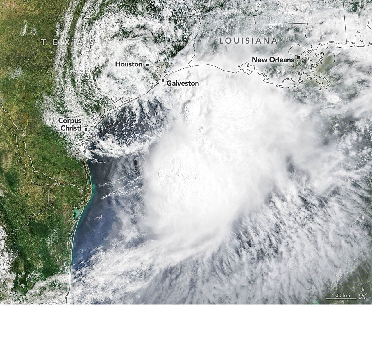
Terra captured natural-color and infrared images of Tropical Storm Arthur at 10:30 a.m. Central Time (15:30 Universal Time) on June 17, showing the storm’s cloud structure and cooler cloud tops (white and purple) contrasted with the warmer surface below (yellow and orange).
Around the time the images were taken, the system had just been designated Tropical Storm Arthur by the National Hurricane Center. Though it remained below hurricane strength, Arthur tracked northeast and produced maximum sustained winds of 40 miles (65 kilometers) per hour, with tropical-storm-force winds extending 175 miles (280 kilometers) from the center; a gust of 48 miles per hour was measured at Galveston, Texas.
The storm delivered intense rainfall and prompted warnings of life-threatening flash flooding from the National Weather Service. IMERG estimates showed high rainfall rates over Gulf waters and pushing inland on June 17, and Arthur continued to carry abundant moisture into central Gulf Coast states on June 18.
United States, U.S. Gulf Coast
tropical storm, arthur, gulf coast, heavy rain, flash flooding, hurricane center, weather service, galveston, terra satellite, imerg