
Star-Spangled City: Baltimore and Fort McHenry
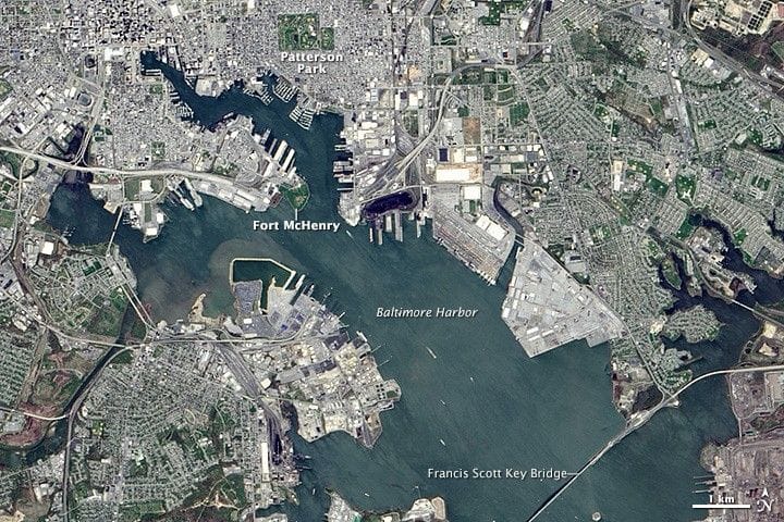
On April 24, 2014, the Operational Land Imager on Landsat 8 captured a view of Baltimore and its harbor, centered on Fort McHenry and its star-shaped ramparts—the place where “that star-spangled banner yet wave[d]” on September 14, 1814. In September 1814, British naval and ground forces advanced on Baltimore after burning the White House and the Capitol in Washington on August 24.
British troops landed at North Point on September 12 and engaged American forces; by the 13th land assaults were repelled by U.S. Army and Maryland militia positioned behind a mile of earthworks along Hampstead Hill, near today’s Patterson Park. That morning, British ships took positions off Baltimore Harbor and began a 25-hour bombardment of Fort McHenry, firing rockets and cannonballs from beyond the range of American artillery.
The fort held, aided in part by several merchant vessels deliberately sunk in the harbor, and the attack ended on the morning of September 14.
United States, Baltimore, Maryland
baltimore, fort mchenry, landsat 8, satellite image, star-spangled banner, 1814, north point, hampstead hill, patterson park, bombardment