Signs of Thaw in the Bering Sea
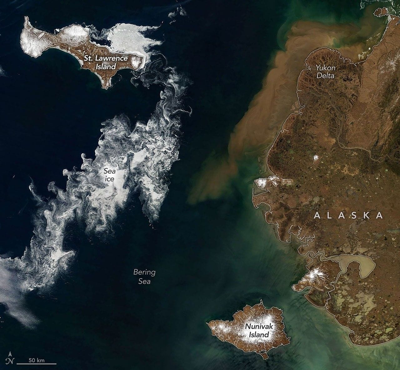
When clouds parted in early June 2026, satellites captured signs of summer approaching the Bering Sea off Alaska. Sea ice had broken into small fragments that spun and drifted as it melted, while rivers swollen with snowmelt flushed sediment and organic material into coastal waters.
The images, acquired on June 3, 2026, with the MODIS instrument aboard the Terra satellite, show the seasonal transition in both natural and false color. In the false-color view, tundra and marsh vegetation appear green, ice-free rivers and thermokarst lakes are dark blue, and lingering sea ice and snow show as light blue.
Saint Lawrence and Nunivak islands, both of volcanic origin with extensive basaltic lava flows, sit amid these seasonal changes. Saint Lawrence Island lies about 150 miles (240 kilometers) south of the Bering Strait and is one of the remaining pieces of the Pleistocene land bridge; pack ice persisted along its northeast side while other ice curled into intricate patterns under the influence of winds and currents.
United States, Alaska
bering sea, sea ice, thaw, modis, terra satellite, saint lawrence, nunivak island, thermokarst lakes, snowmelt, false color