
San Francisco’s Metropolitan Mosaic
A period of unsettled weather brought scattered showers and thunderstorms to the Bay Area on May 27, 2026, but a break in the clouds left downtown San Francisco and nearby communities mostly clear for an astronaut aboard the International Space Station to photograph the region.
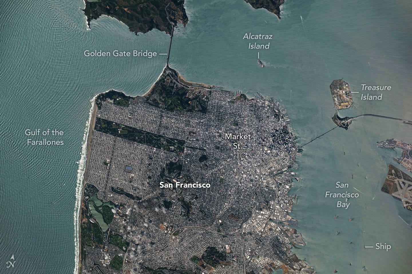
The image captures the Golden Gate Bridge, which links the northern San Francisco Peninsula with Marin County, and the San Francisco–Oakland Bay Bridge, which spans the bay toward Oakland. Near the center of the scene, Golden Gate Park appears as a long, rectangular strip of green amid dense urban development.
The park spans more than 1,000 acres (400 hectares) and contains meadows, gardens, wooded areas, and lakes. Additional green space north of the Golden Gate Bridge forms part of a national recreation area, while the nadir perspective highlights the patchwork of street grids imposed across San Francisco’s hilly terrain and the role of Market Street in dividing two distinct grid orientations.
san francisco, bay area, golden gate, bay bridge, space station, astronaut, marin county, market street, oakland, street grids