Rising Waters Swamp Lake Naivasha
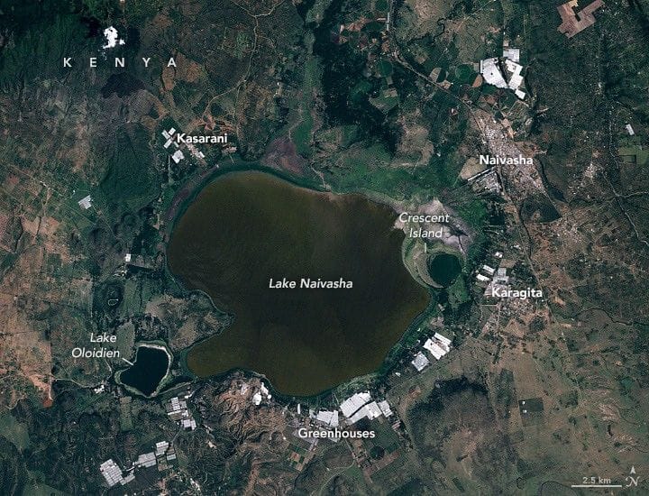
Lake Naivasha in Kenya’s Great Rift Valley has seen rapid and large fluctuations in recent years. Satellite altimetry shows the lake’s depth has increased by about 7 meters since 2010, while Landsat imagery indicates roughly a 40 percent rise in area, adding about 50 square kilometers; images compare January 2010 with January 2026.
The lake’s Maasai name, meaning “that which heaves,” reflects this variability. Rising waters have flooded homes, flower farms, and roads along the shore, displacing many people. Lake Oloidien has effectively merged with Naivasha, bringing more saline, alkaline water into the freshwater system, and neighborhoods such as Kihoto have seen entire blocks, police stations, churches, hotels, restaurants, power substations, and sewer systems inundated.
Kenya, Naivasha
lake naivasha, kenya, rift valley, lake oloidien, satellite altimetry, landsat imagery, flooding, flower farms, saline water, kihoto