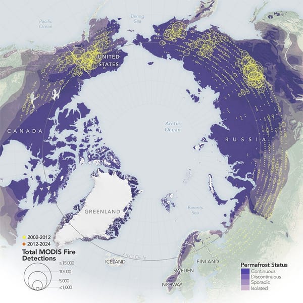
Satellite-based maps from NASA show wildland fires in the far north have become more frequent and widespread, with the largest increases occurring in northern Eurasia. The maps use fire detections from the MODIS sensors on NASA’s Aqua and Terra satellites and compare detections from 2002–2012 (yellow) with 2012–