Fire charred one-third of Santa Rosa Island
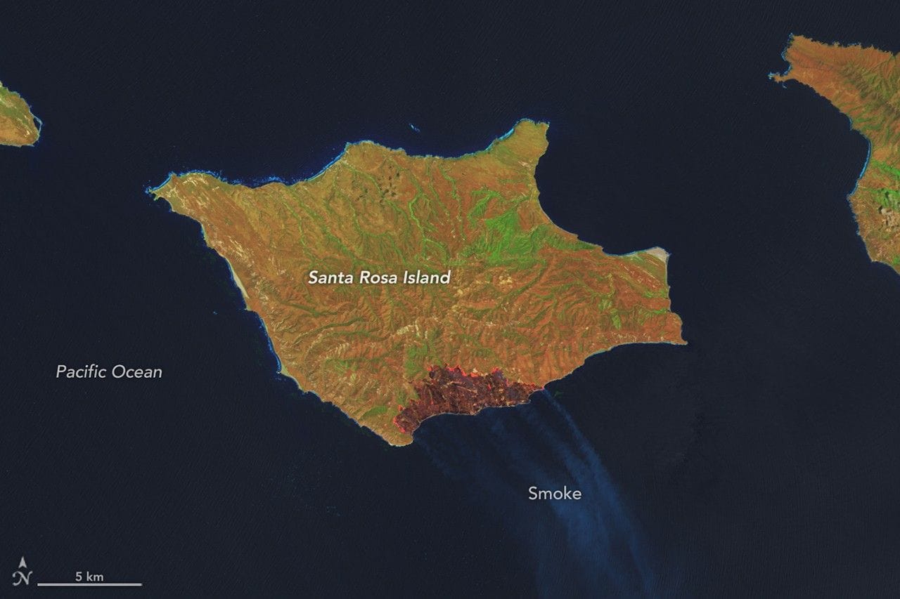
On May 15 a wildfire was spotted on the southeastern side of Santa Rosa Island. Over the next several days the blaze grew to consume 18,379 acres (7,438 hectares), roughly one-third of the island. False-color Landsat images from May 16 and May 24 highlight the burned areas in brown and healthy vegetation in green.
By the evening of May 26 officials reported the fire was 97 percent contained. Satellite-based monitoring showed the flames moving north and east as the fire advanced, burning through grassland, coastal sage scrub, and island chaparral. There was concern for the island’s Torrey pines, which naturally grow there and near San Diego.
Initial post-fire surveys by firefighters and unmanned aircraft found the Torrey pine stand largely intact: the fire mostly burned at low intensity beneath the pines and spared the canopy, though some pockets of forest were damaged where the fire burned hotter.
santa rosa, wildfire, torrey pines, landsat, burned area, containment, satellite monitoring, island chaparral, sage scrub, unmanned aircraft